
Pedaling among the hills of Dogliani
Business Hours
Contacts
This hike takes you up and down the hills of Dogliani DOCG, exploring both the north and south sides of the small village considered the capital of dolcetto.
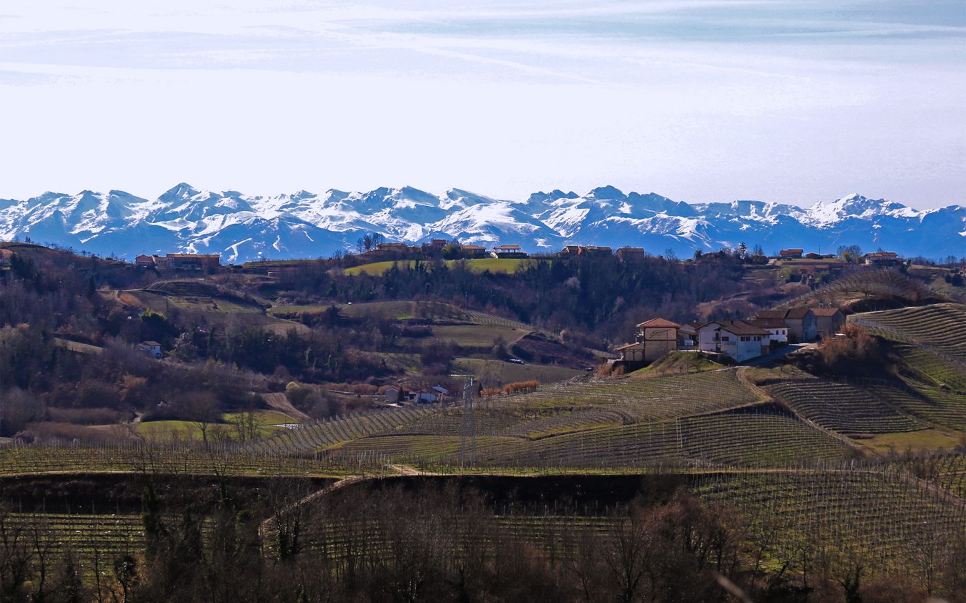
Like all the Langhe, the Dogliani area offers many shades of perspective.
Each hill is different and offers views and landscapes that change in just a few kilometers
One thus easily realizes how different microclimates, exposures and environmental conditions can foster the great variety of flavors and aromas in the wines produced for centuries in these areas, and one also appreciates the variety of soils that now favor vine cultivation and now hazelnut cultivation.
A small premise
The route is entirely on a paved road and is designed for cycling. It is suitable for everyone and presents no particular difficulty.
However, it must be said that there are three climbs with gradients around 10% that require a minimum of training if you want to tackle them in the saddle instead of pushing the bike!
If you’re not prone to fatigue, go for the electric bike-a great way to get exercise, enjoy the scenery without exerting too much effort, and enjoy a relaxing ride.
Ups and downs going north
We start from the village of Dogliani, little flatland and the climb begins immediately!
There is little to do, we are in the hills and so we are always pedaling uphill or launching downhill, there are very few flat sections.
We start from Piazza Umberto I and take via Marconi north, which past a small traffic circle in front of the post office becomes Strada Provinciale 9.
We begin to climb by turning left, and after about 400 meters, at a hairpin bend just before the Cà Viola winery, we leave the main road for a detour to the left.
This small side road allows us to climb while avoiding car traffic.
The first moment of fatigue
We meet a second fork in the road and keep right to continue uphill. Here we encounter the first major incline; there will be two more along the way.
When we reach the top we rejoin the main road, and at this point we begin to understand the location of Dogliani in relation to the Langhe. On our left we see the plain leading to Turin, in front of us the wine hills, and on our right the Alta Langa.
Vineyards and the Alta Langa
We continue along the road into the heart of the San Luigi vineyards.
When we reach a fork at the bottom of a short descent, we turn left following the sign for Dogliani, leaving the road to Monforte d’Alba on our right.
We descend along Strada Provinciale 9 to a fork where we take a rather steep climb to the left, also called Sp 9.
We ascend until we cross the Valdibà hamlet, which we take to the right.
We make a stretch on the ridge, and to our left the hills of the Alta Langa show themselves, recognizable because they are cultivated with hazelnuts.
We follow the main road downhill back to Dogliani, crossing via Codevilla and returning to our starting point in the center of town.
The hills to the south toward Farigliano
At this point we start climbing again along via Savona, in the direction of Belvedere Langhe, and arrive at the fortress of Borgo Castello, the upper part of the village, which is very characteristic and dominates the town of Dogliani.
At the height of the very recognizable cemetery with the entrance designed by architect G.B. Schellino, we take the road to the right along the Biarella hamlet, flat for about 4 kilometers.
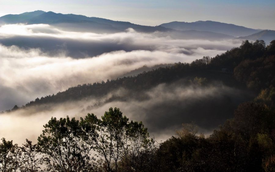
We are on a kind of plateau halfway up the hills, and we can see how the landscape is different from the first half of the route.
Photos by Michele Caroselli
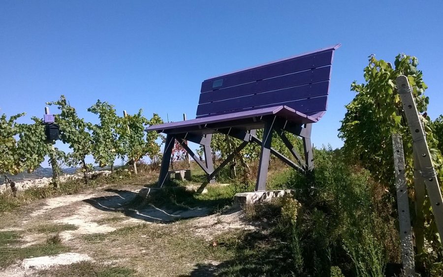
San Nicolao and the giant bench
We cross Strada Provinciale 9 again and take it to the left, in the direction of Dogliani, to leave it after a few meters by taking the fork to the right with the sign for the chapel of San Nicolao.
With the chapel on our right, we go up along the main road to arrive in the hamlet of Giachelli. This road is very narrow but not very busy.
We cross Farigliano‘s giant bench on the left and continue climbing to reach the highest point of the trail, 56o meters above sea level.
At one point we cross the SS 661, and take it downhill (left) toward Dogliani, instead of going up toward Belvedere Langhe.
From here it is all downhill to Dogliani, for about 5 kilometers.
Tasting break!
About halfway down the slope, after an S-curve, we find a fork to the right towards the village of Pamparato.
Going up less than a kilometer we find the Marenco winery, which has been producing the wines of the area for several generations.
An interesting alternative to combine hiking and tasting
Stop by the winery for a tasting to meet the owners and take a pleasantly educational break.
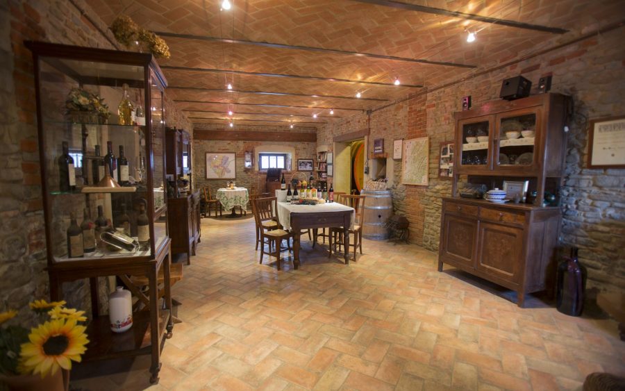
The tasting room, rustic and warm
One more idea
Marenco Winery, in addition to the winery tour, offers e-bike rentals and also prepares you a picnic basket.
If you don’t have a bike, you’re passionate about wine and want to plan a different day out, contact them to book your experience (Italian content only)!
I am sure that this excursion will make you appreciate the beauty of an area of the Langhe that is less famous than others, but rich in interest for those who like to know the most authentic corners of the area.
Now you have no excuse, all you have to do is get on the saddle and start pedaling.

Eat & Drink in High Langa


Are you planning a trip in the Langhe region?
Let us help you design the perfect vacation, and live your stay like a true insider
Free
Service
Ask us
For advice
Free Service
Ask us
For advice
Free Service

Fill in the form
reporting your interests and preferences
Receive our suggestions
directly into your inbox
And if it's not enough
we'll design a personalized trip!